Day 29 - Albany to Esperance
The aim for the day is to climb a tall mountain and then just make it to Esperance in one piece.
Quick Stats
- 5 hours on bike
- 494 km
- 10329 km total
I'm up early again to get a good headstart on the day. Visit outside for coffee dashes those hopes, it's cold, so I'll wait an hour for the sun to do its work and go for a walk instead.
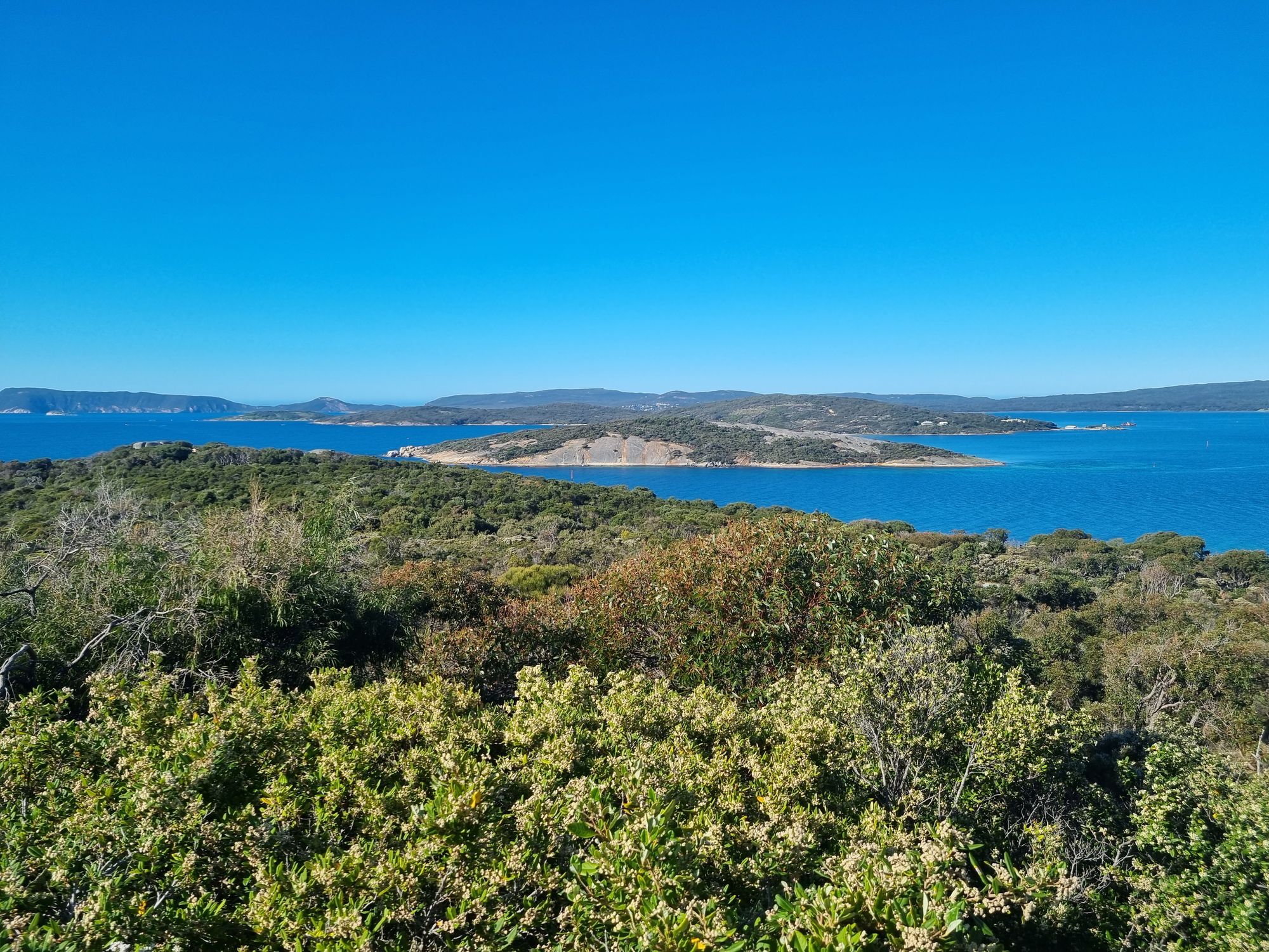
Albany is possibly the prettiest city in Australia, surrounded by nature, the calm King George's Sound, white sand beaches, granite dome slabs and seemingly even some surf. I can say that with some confidence as I believe Albany is the last city in Australia for me to visit.

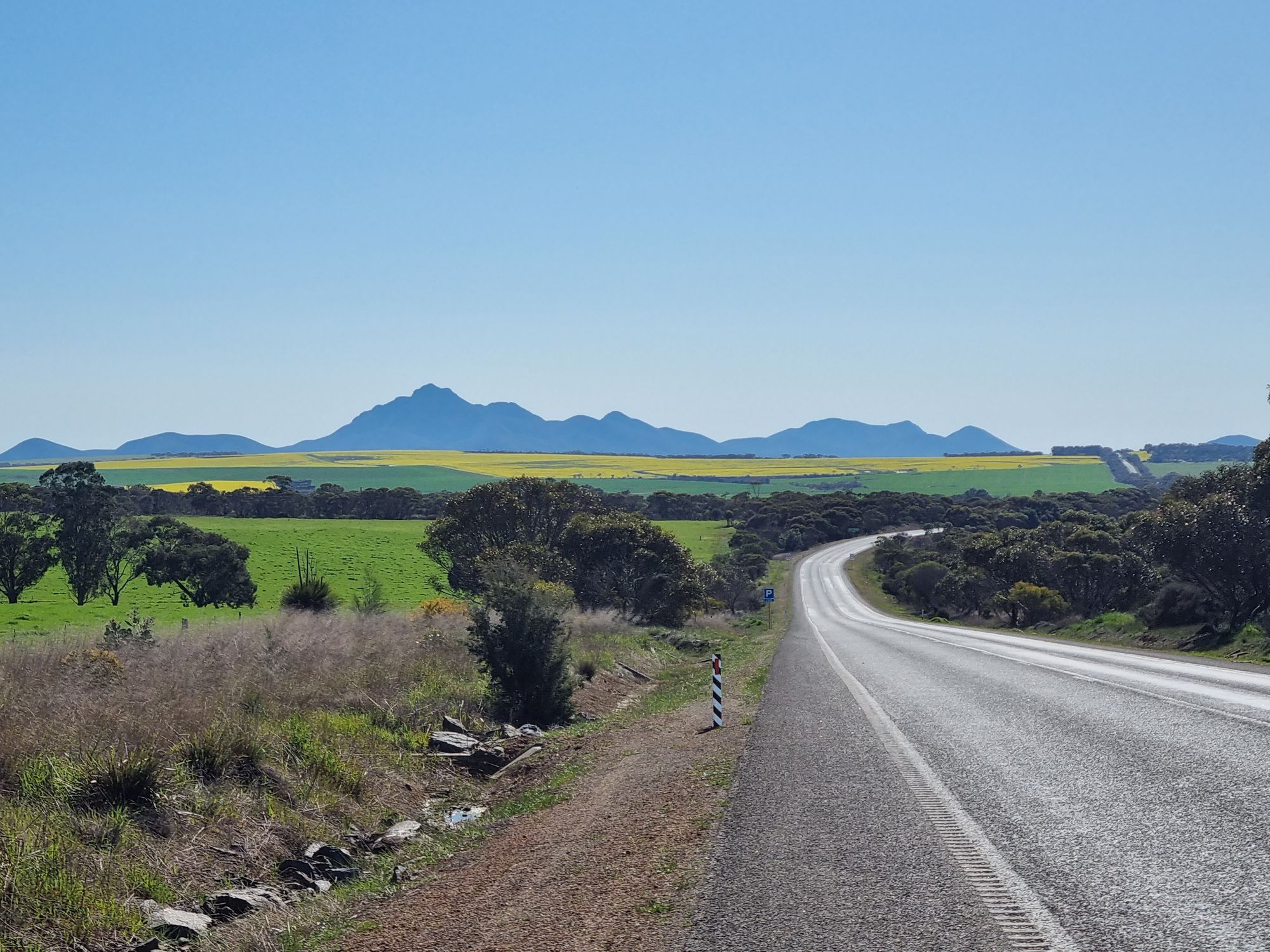
Albany also gets to lay claim, somewhat, to the nearby Stirling Ranges National Park. The Stirling Ranges feature far and away the tallest peaks within a thousand kilometre radius.
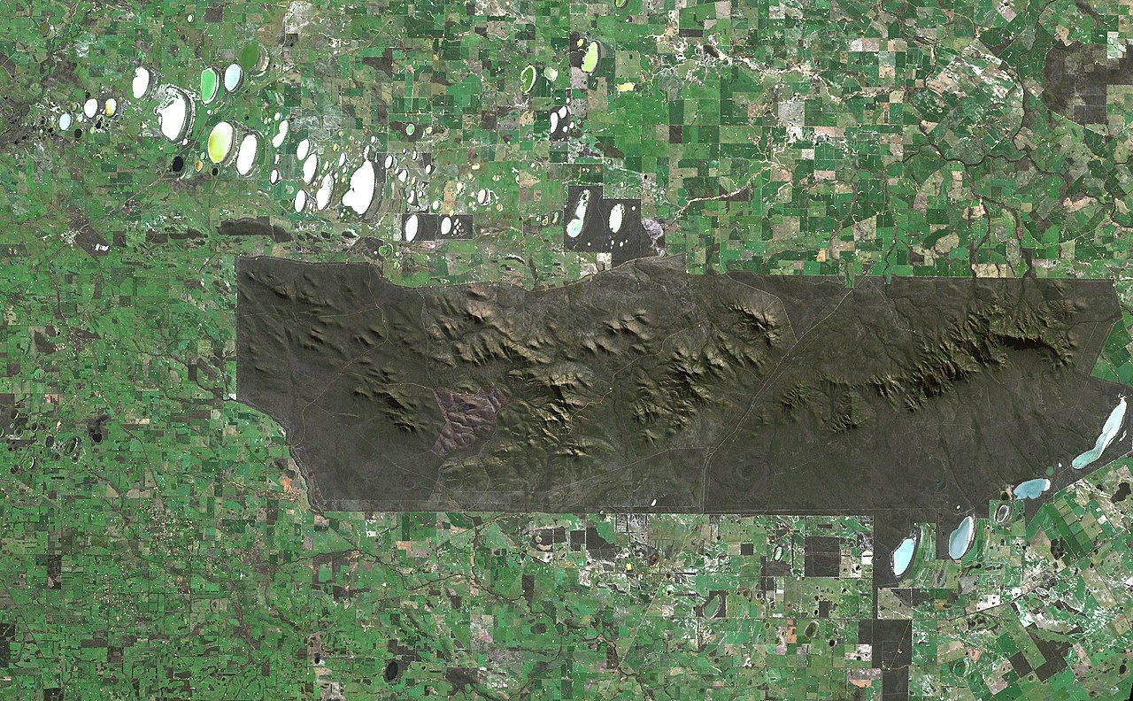
The saving grace for the region is most likely the highly poisonous bushes of the area. This kept sheep farmers out until the area was officially gazetted a national park in 1913.
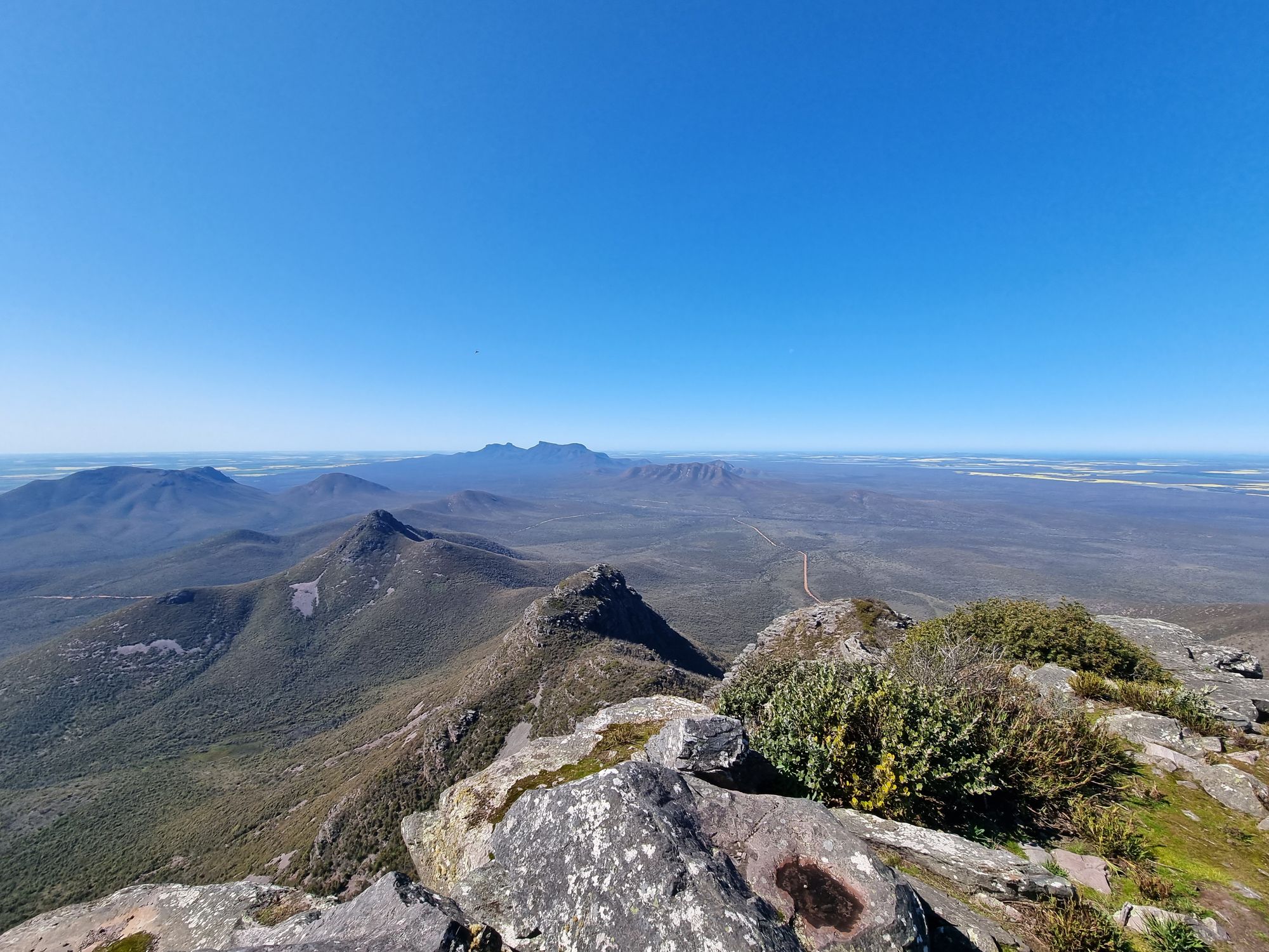
I head off for the range, about an hour north of Albany, with the intention of climbing Mt Toolbrunup. "But Isaac", I hear you say "Bluff Knoll is 40 metres highest, and the tallest peak (at 1099 metres).
Well, following the Black Summer bushfires in 2020, the track to Bluff Knoll has been rebuilt and is now just a series of stairs. This sounds horribly boring. This also makes it the primary tourist peak, so likely to be very busy. I want a good scramble to stretch my legs.

As if to prove my point, I take the four kilometre dirt road to the carpark to find it empty.
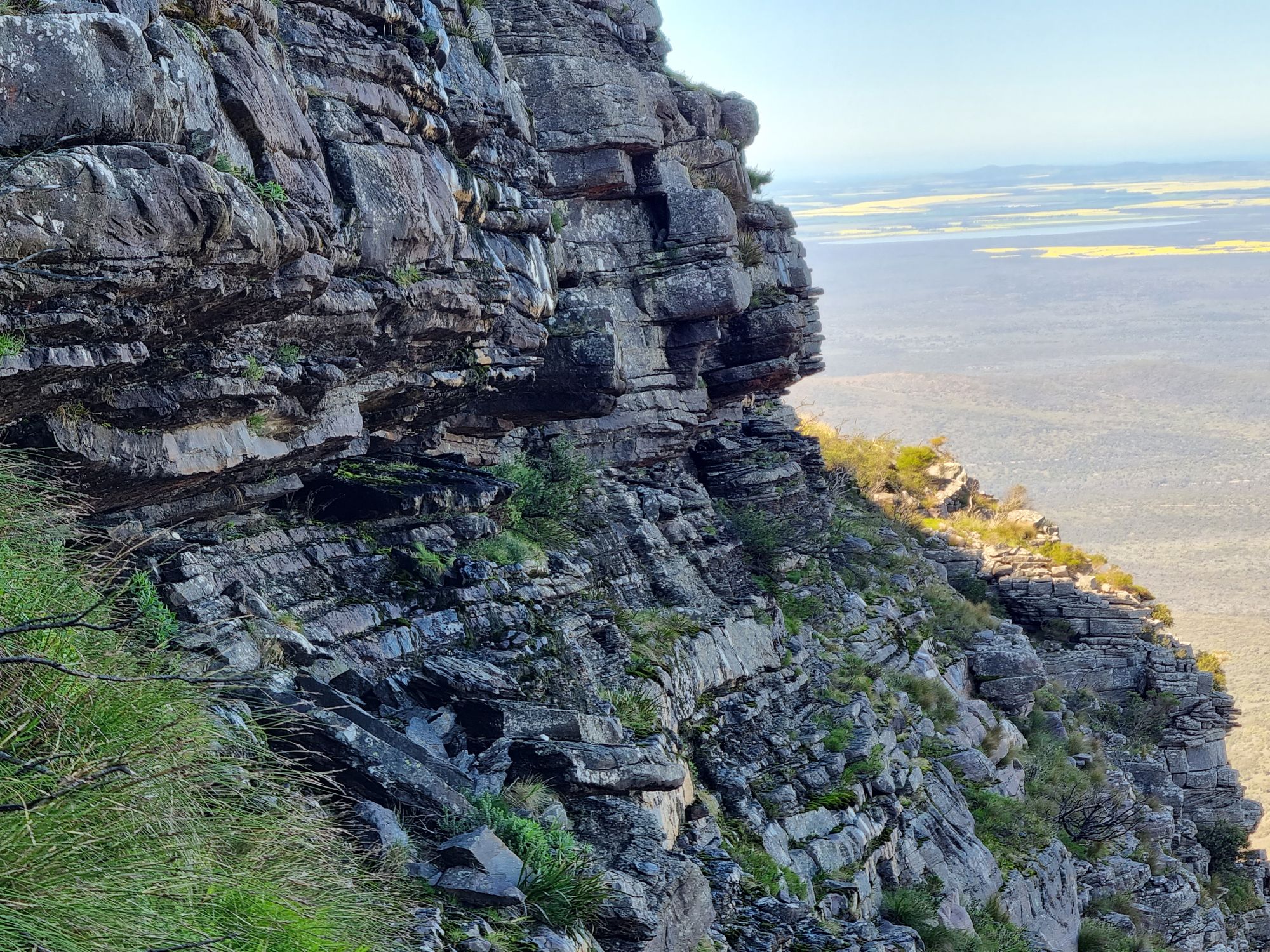
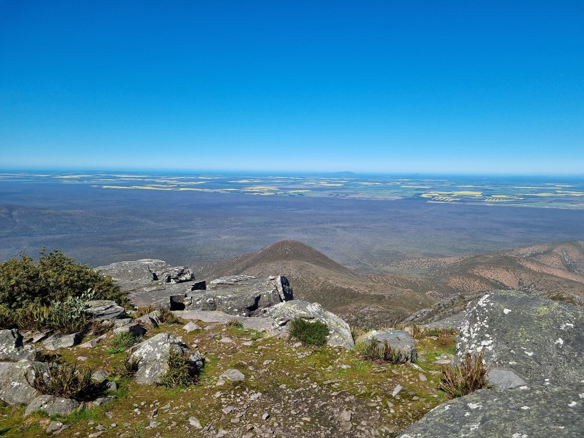
A quick clothing change and I'm off up the mountain. The elevation gain of the track is immediate with a rocky trail following a flowing creek. The route up is only 2.5 km with a 550 metre elevation gain, so I'm expecting steep.
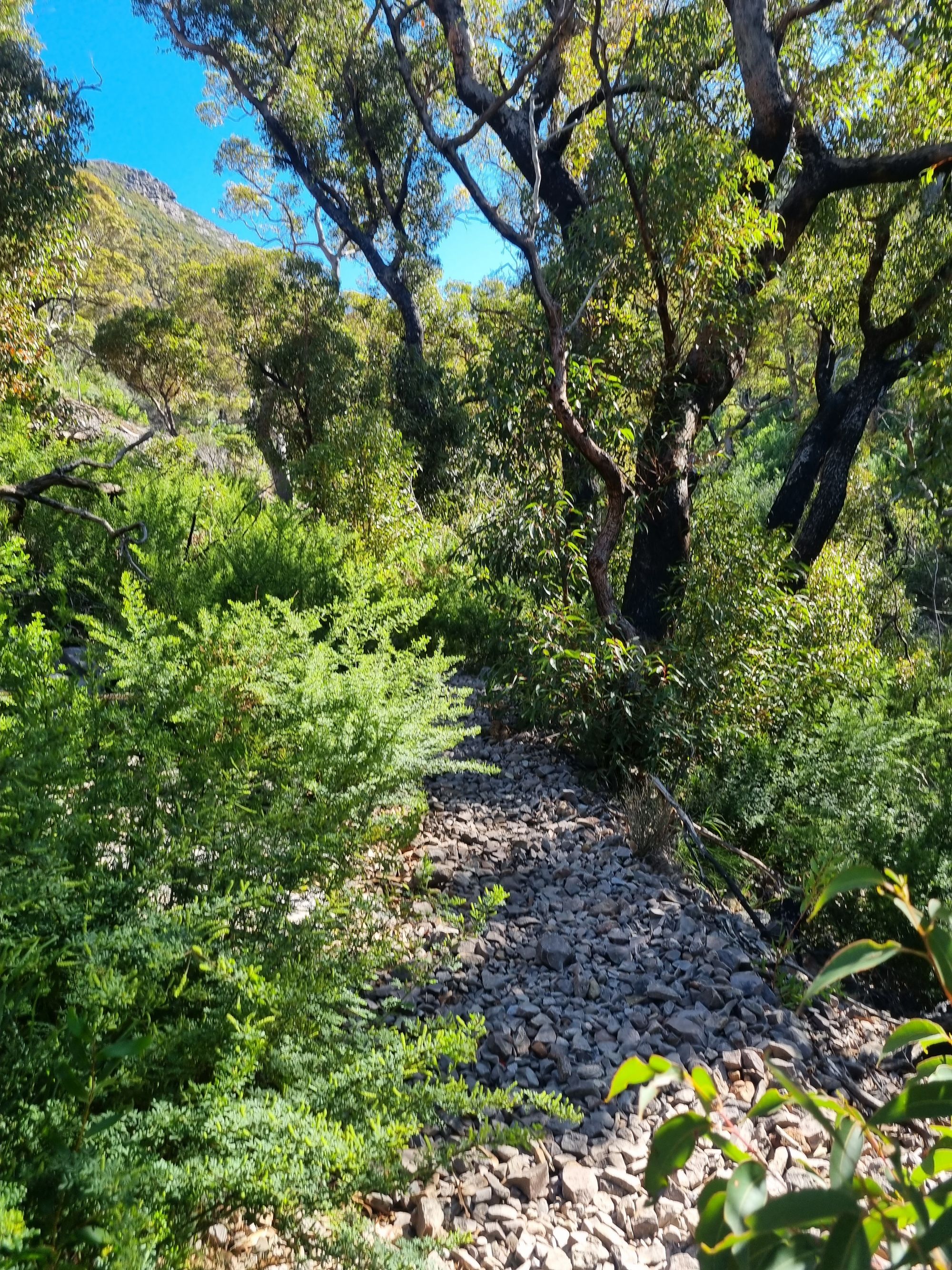
The sharp rock slog uphill is getting a bit old, but soon enough I'm out of the forest into open boulder field.
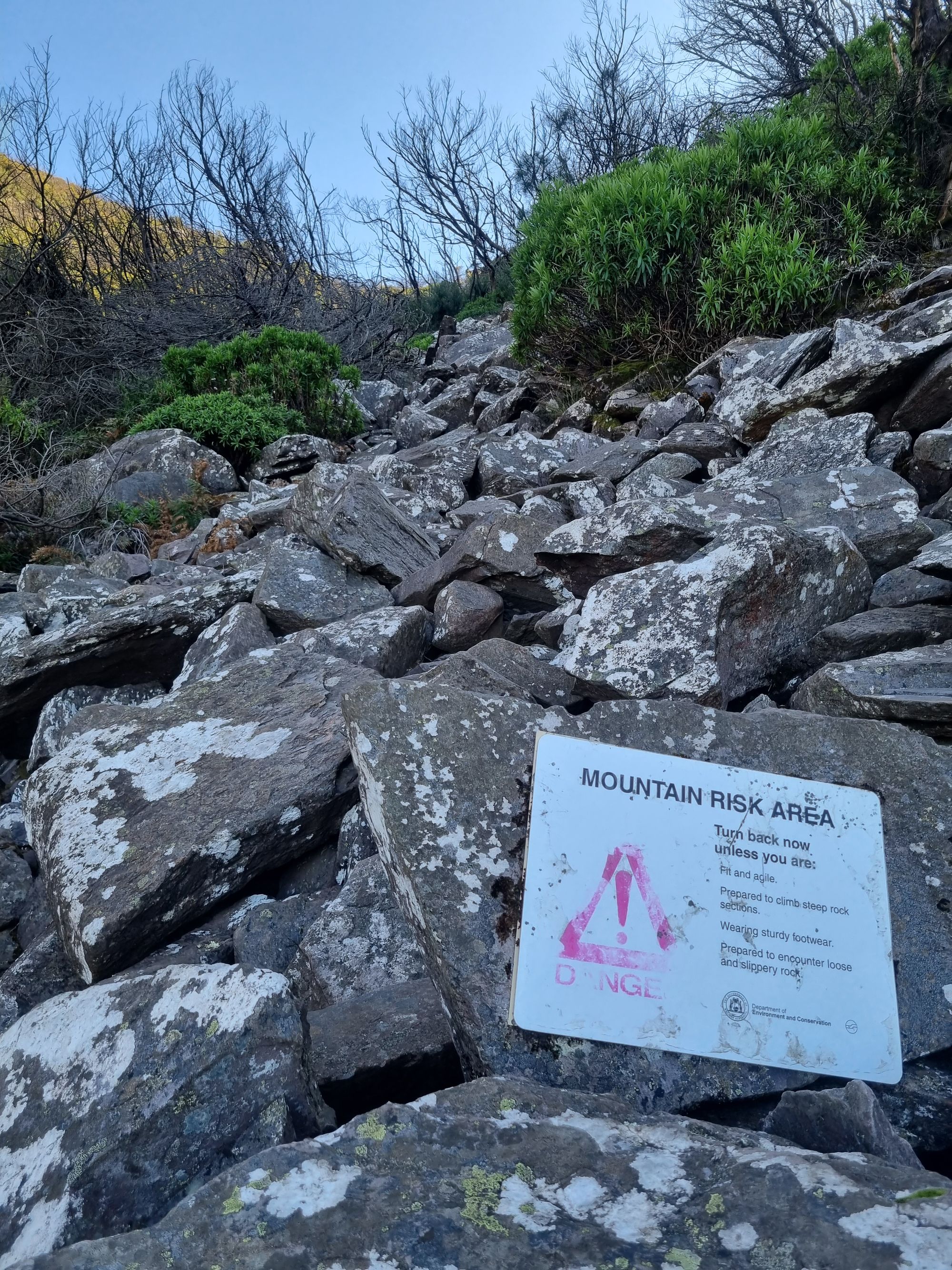
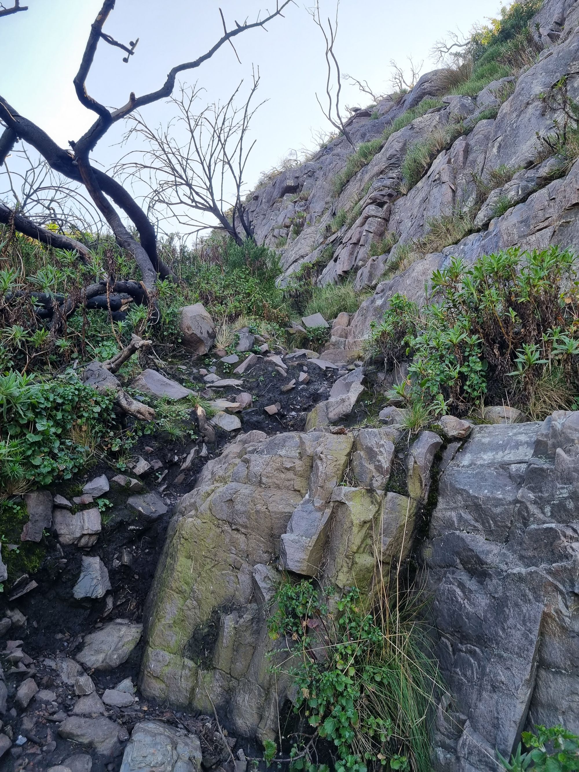
These boulders are pretty poorly seated and this proves to be a fairly sketchy climb. I follow for another thirty minutes until I hit the final rock slab scrambles to the peak.
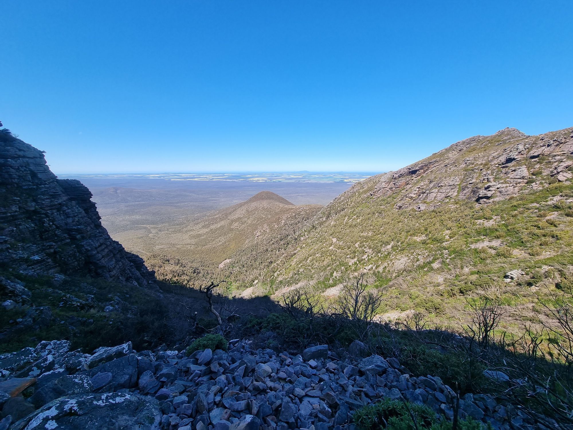
The ground is very moist here, and so are my vapour-filled exhalations. It's easily ten degrees cooler up here than at the base. I'm told Toolbrunup and Bluff Knoll are the only places in Western Australia to get reliably snow in the winter.
Not much further and I'm climbing a boulder onto the summit.

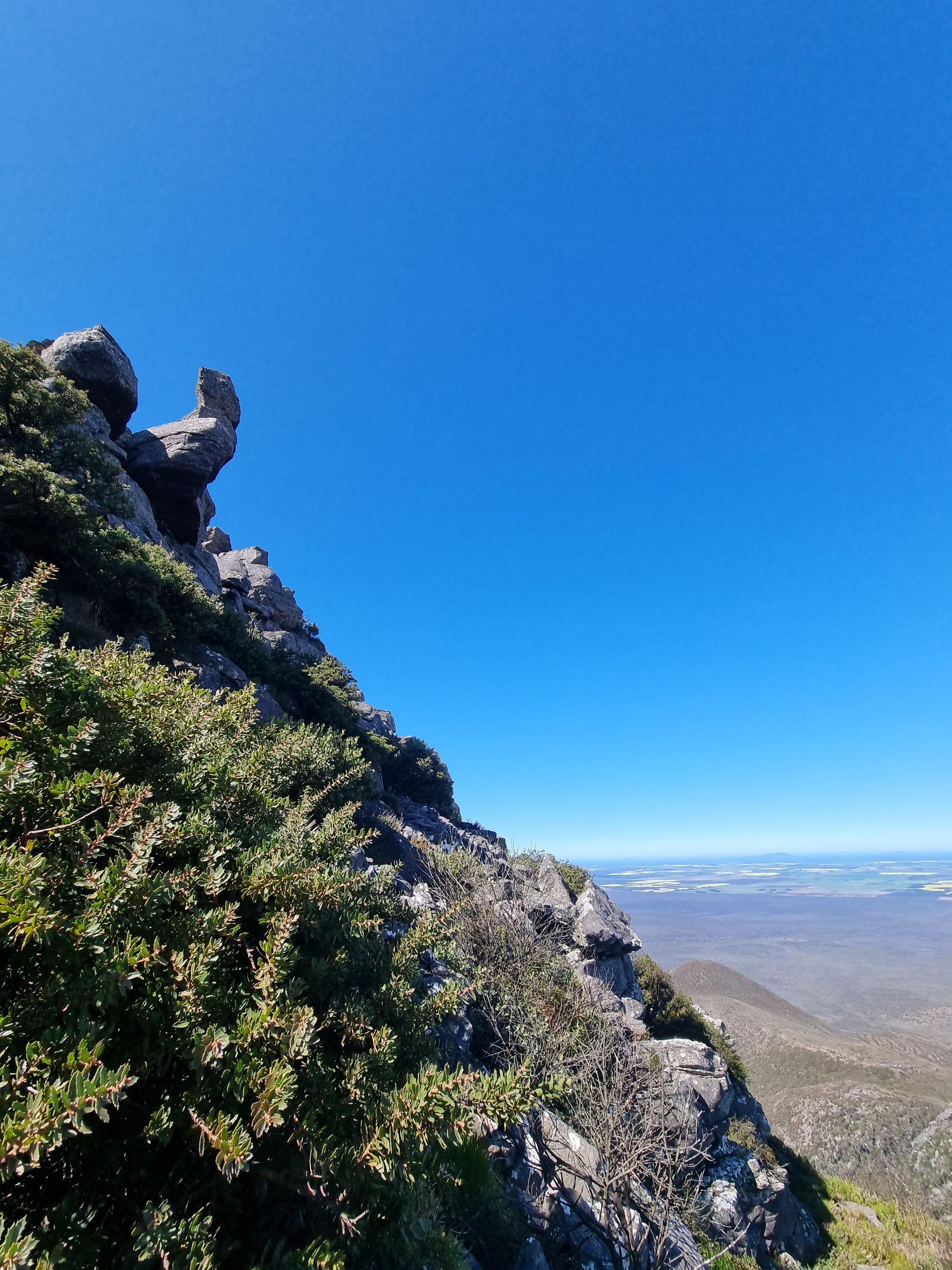
I've once again lucked out on the weather today, absolute blue skies with a 360 degree view.
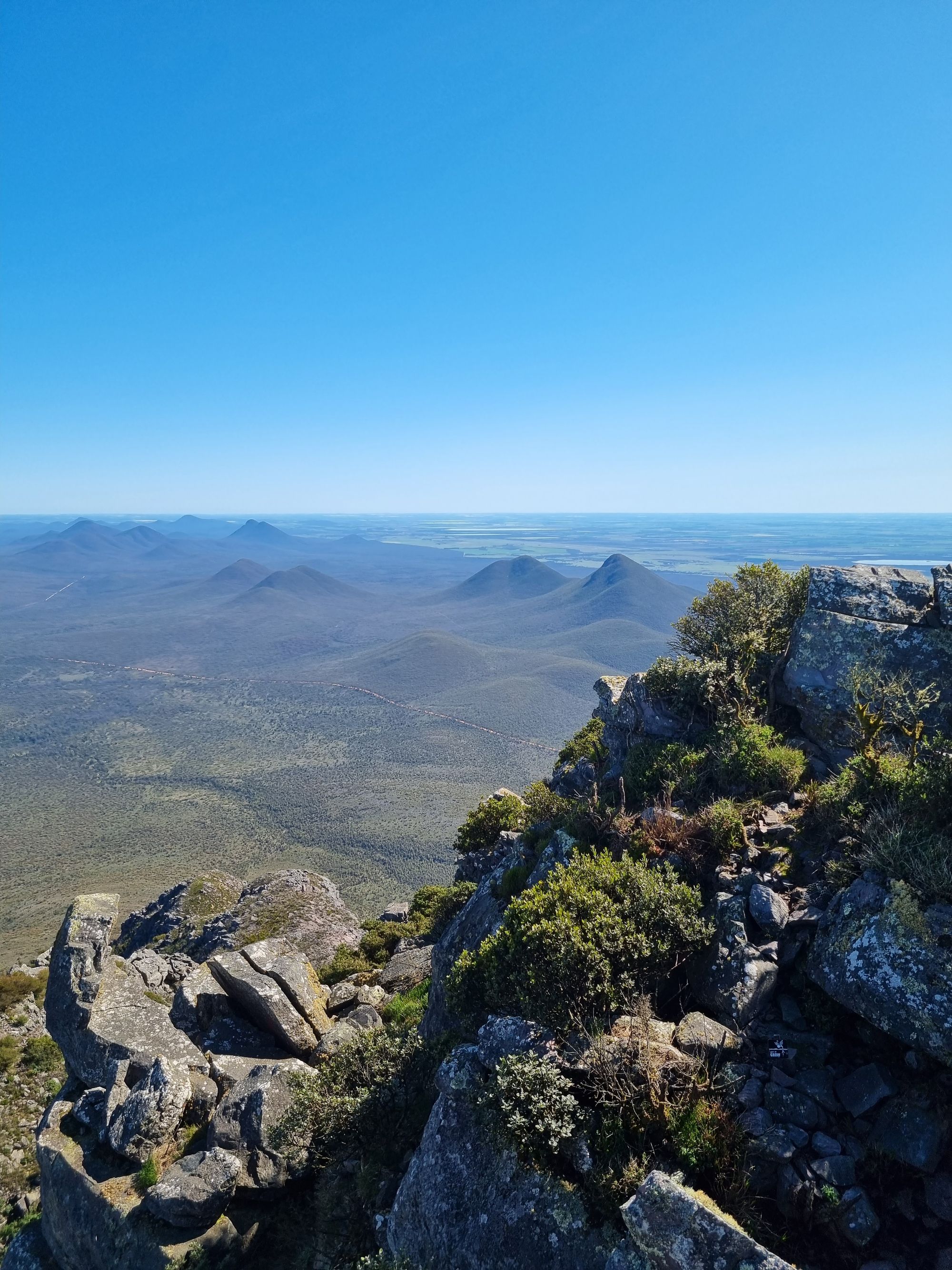
I sit for a while, have some lunch, and watch the wedge-tailed eagles circle the nearby summits. I can't stay for long though, its 12.30 pm and I have 4 hours more riding.
I scramble down, arriving back at the carpark by 1.15. Waving goodbye, I head for the highway and to Esperance along the coast.
Livestock farming was the major economy through this region until fairly recently, in the 1960's, when American farming conglomerated bought up larges chunks of land to convert for grain farming. Australians follow suit and now, as I ride along, it seems far and away the majority of land.
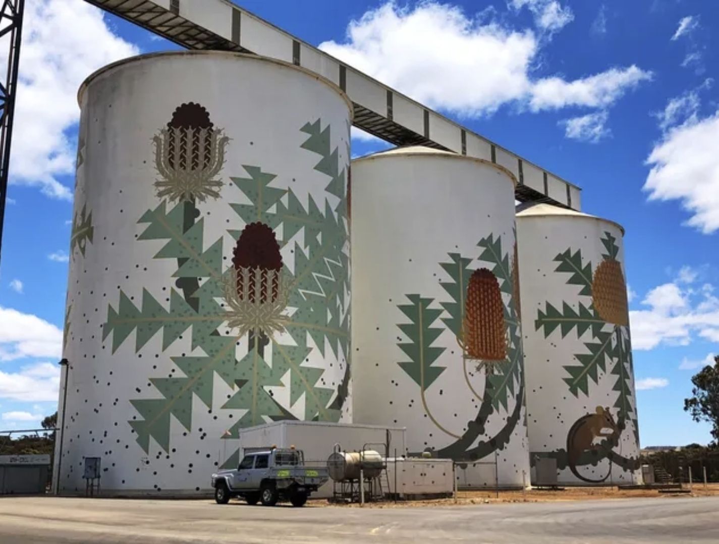
This is demonstrated as I enter Ravensthorpe. A big thing in the region is the painting of grain silos, there's even a published route to experience them all.
Quick fuel up, though, and I need to motor. You don't want to be riding after dark around here and my ETA is five minutes after sunset.
I cross Rabbit Proof Fence No. 1 just outside of Jerdacuttup. At one point the longest unbroken fence in the world. Also just outside of Jerdacuttup is the first visible mine I've seen since the Pilbara.
While the region saw a massive gold rush in the 1890s, it seems mostly about nickel and lithium now.
Arriving in Esperance just before sunset, I check into my hotel and immediately extend for a second night. I'm pretty battered and need a rest day.