Day 31 - Esperance to Nullarbor Adjacent
A big day of travel to break the back of the Nullarbor stretch.
Quick Stats
- 8 hours on bike
- 849 km
- 11208 km total
The Nullarbor plain is made out as the most empty, devoid and lifeless stretch of the highway in Australia. "Nullarbor" deriving from Latin means "no tree".
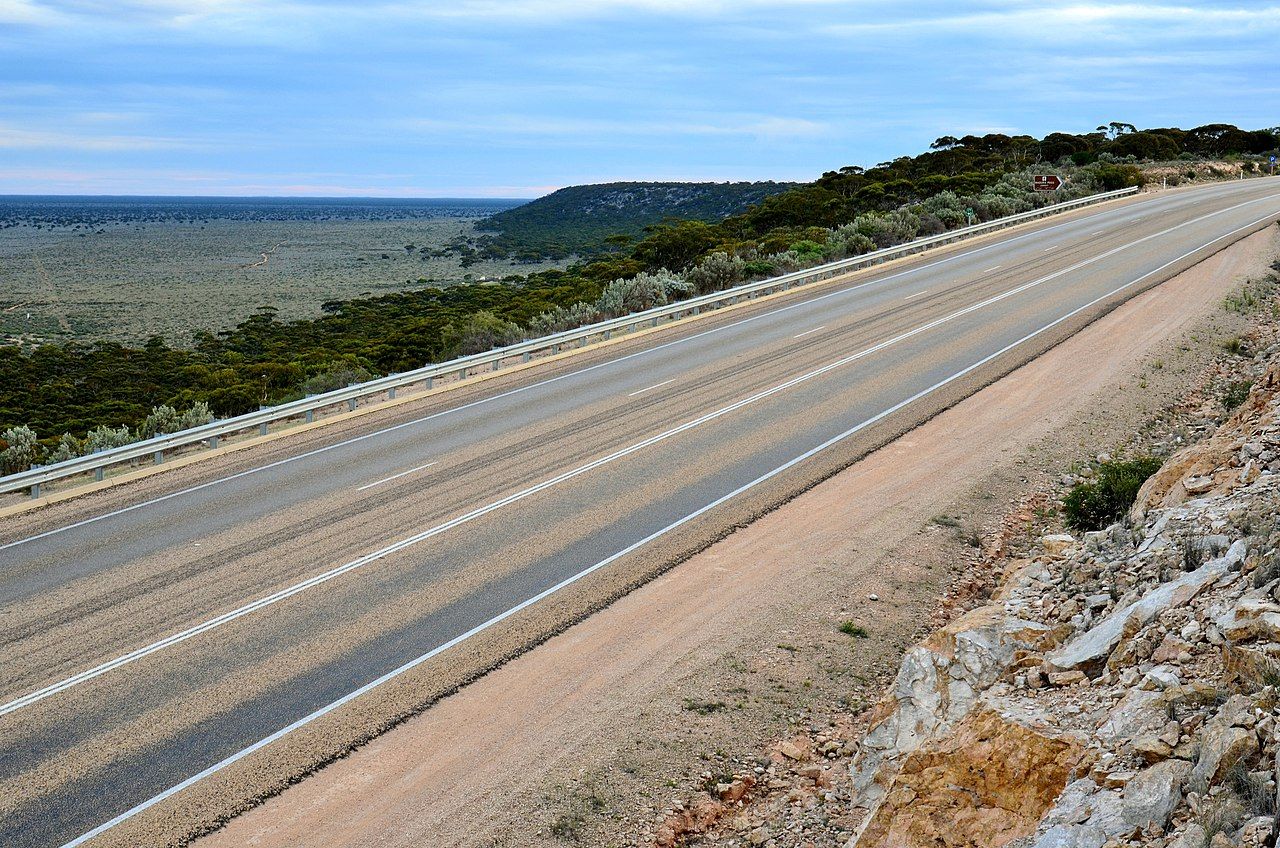
Stretching from Norseman in WA just south of Kalgoorlie to Ceduna in South Australia, the Eyre Highway cuts across 1,644 kilometres either on or adjacent to the plain.
Today I'm going to tackle as much of the Western Australia side as I can, aiming for Eucla. That makes a 900+ km day.
With that in mind, I pack up the night before and am on the road by 7.30 am. A quick goodbye to Esperance as a drizzling rain falls across the coast.
The ride from Esperance is quite pleasant, flowing through fields and thickly wooded eucalypt.
My first waypoint, two hours down the road, is a Thai Restaurant in Norseman that serves coffee. You take what you can get, and it's not bad.
Norseman is named after Hardy Norseman, the horse of the brothers that discovered gold nearby, and thats about the closest thing to interesting about Norseman.
Leaving Norseman, I turn right onto the Eyre Highway. At this point, I'm expecting all life to cease and be crossing the surface of Mars. Instead, the shrubbery gets a bit browner, the trees a bit more stunted, but otherwise it remains mostly the same.
Another two hours down the road, I pull into Belladonia, a roadhouse servo. The first of many dots on the map that suggest a town where there is not one.
Belladonia lays claim to the location where NASAs first space station, the Skylab, crash landed. There's some interesting drama about the Skylab where the US?allegedly redirected it so it wouldn't land in North America, claiming to have safely crashed it into the ocean.
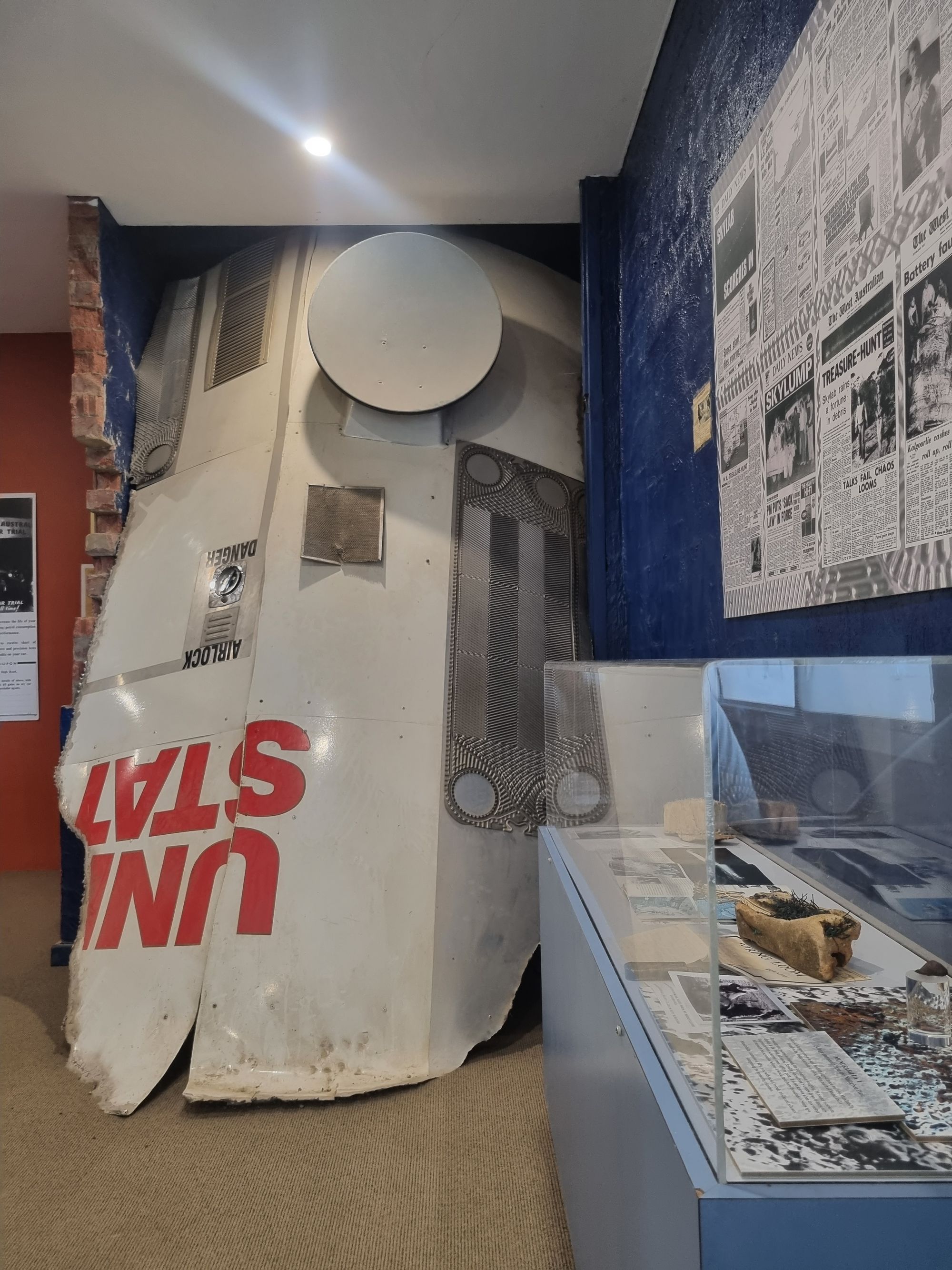
Until some farmers found a few giant chunks of it.
The museum in the roadhouse has quite a bit of information on the first crossing of the Nullarbor by Eyre in the 1840s, the construction if the telegraph line in the 1870s, the highway in 1941 and subsequent sealing through the 1960s.
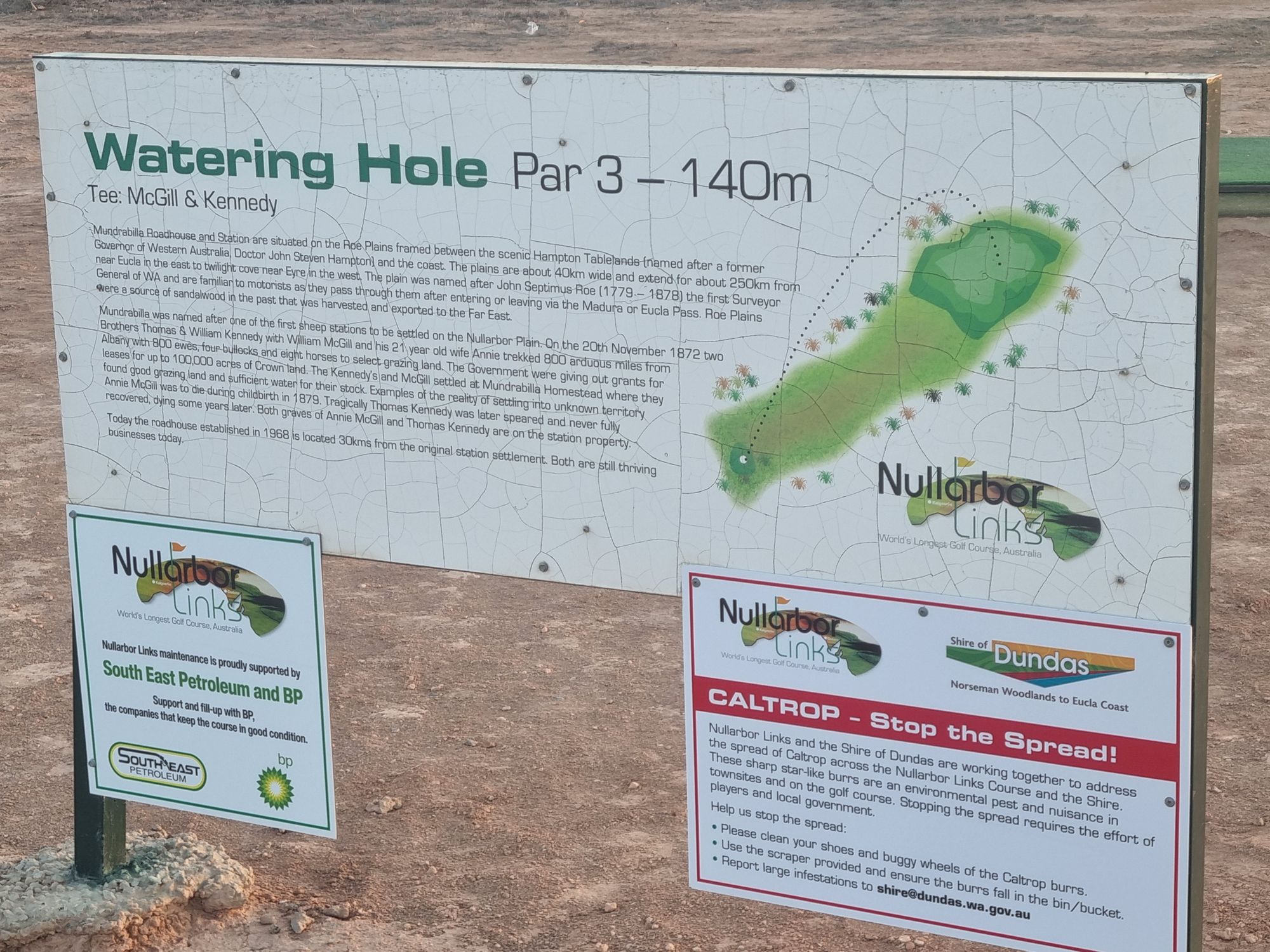
Leaving Belladonia, I can't help but feel this road is nowhere near as remote and devoid as other sections of my ride. There's hills, eucalypt groves, sandy dried lakes, rocks you can almost convince yourself are sheep. There's even a golf course out here.
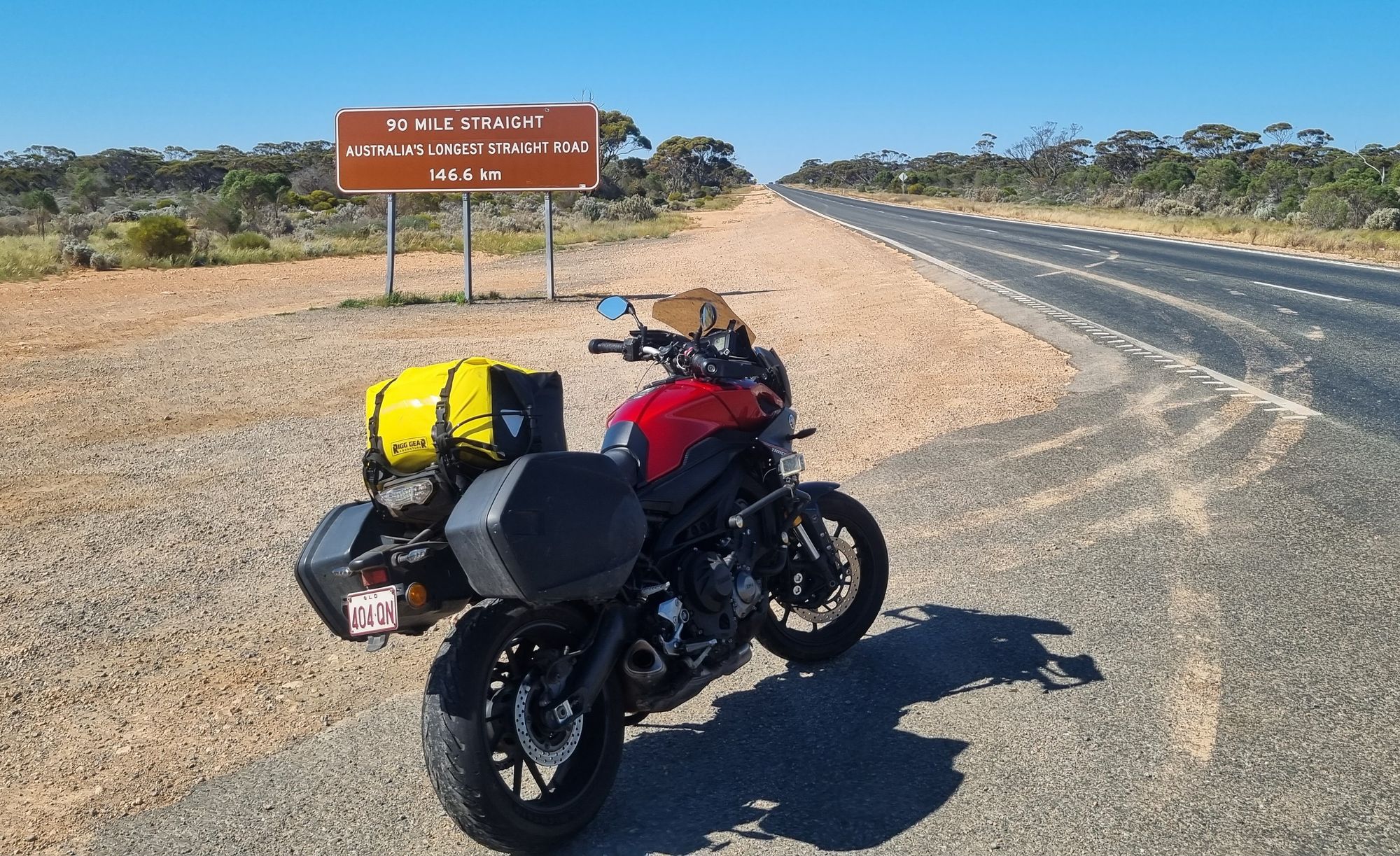
I do start to get a sense of the nothingness though, as I veer left from Belladonia and enter the longest straight road in Australia.

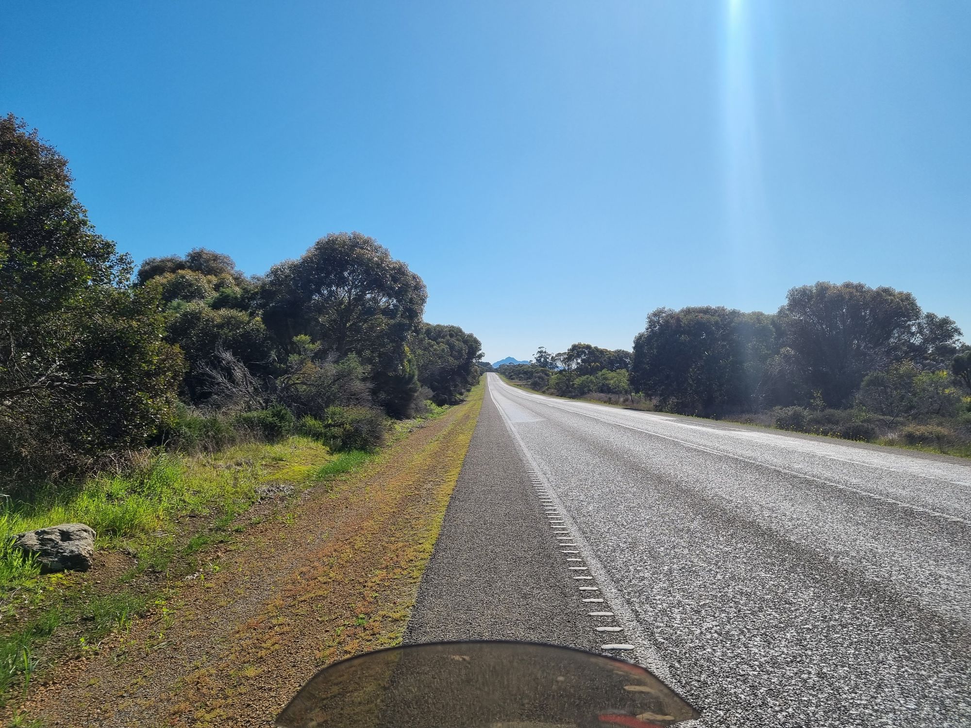
I pondered on this section of road just how far along I could see it to the horizon. I know from my hiking, the horizon is typically around 5 km away for someone my height assuming completely flat.
I've got time on my hands and try figure it out. Pythagoras gets me to figuring it'll be the distance squared divided by the earth's radius.
An hour later the straight ends at the Caiguna roadhouse, and another hour I arrive at Cocklebiddy, another roadhouse. I refuel and grab a snack and do a quick Google.

So I'd need to be at around 1600 metres to see the far end of the straight. About the height of the tallest mountain in South East Queensland. Moving on....
Another odd thing happens as I pass through this section - my clock jumps forward 45 minutes. The Nullarbor has its own timezone, known as Australian Western Central Time. There's probably more blowflies on my face as I read this than population that observes the timezone.
While this still doesn't feel anywhere close to "nullus arbor" as some northern sections I took, its worth mentioning the Eyre Highway skirts the southern edge of the plains. This is in contrast to the railway, which runs straight across the middle a hundred kilometres north.
This is even more evident as I reach Medura Pass and drop off the edge of the Nullarbor into the Roe Plains.
Reaching Medura, I've got about an hour before sunset, so I decide to cut short of Eucla by 70 kilometres and book a room at Mundrabilla.
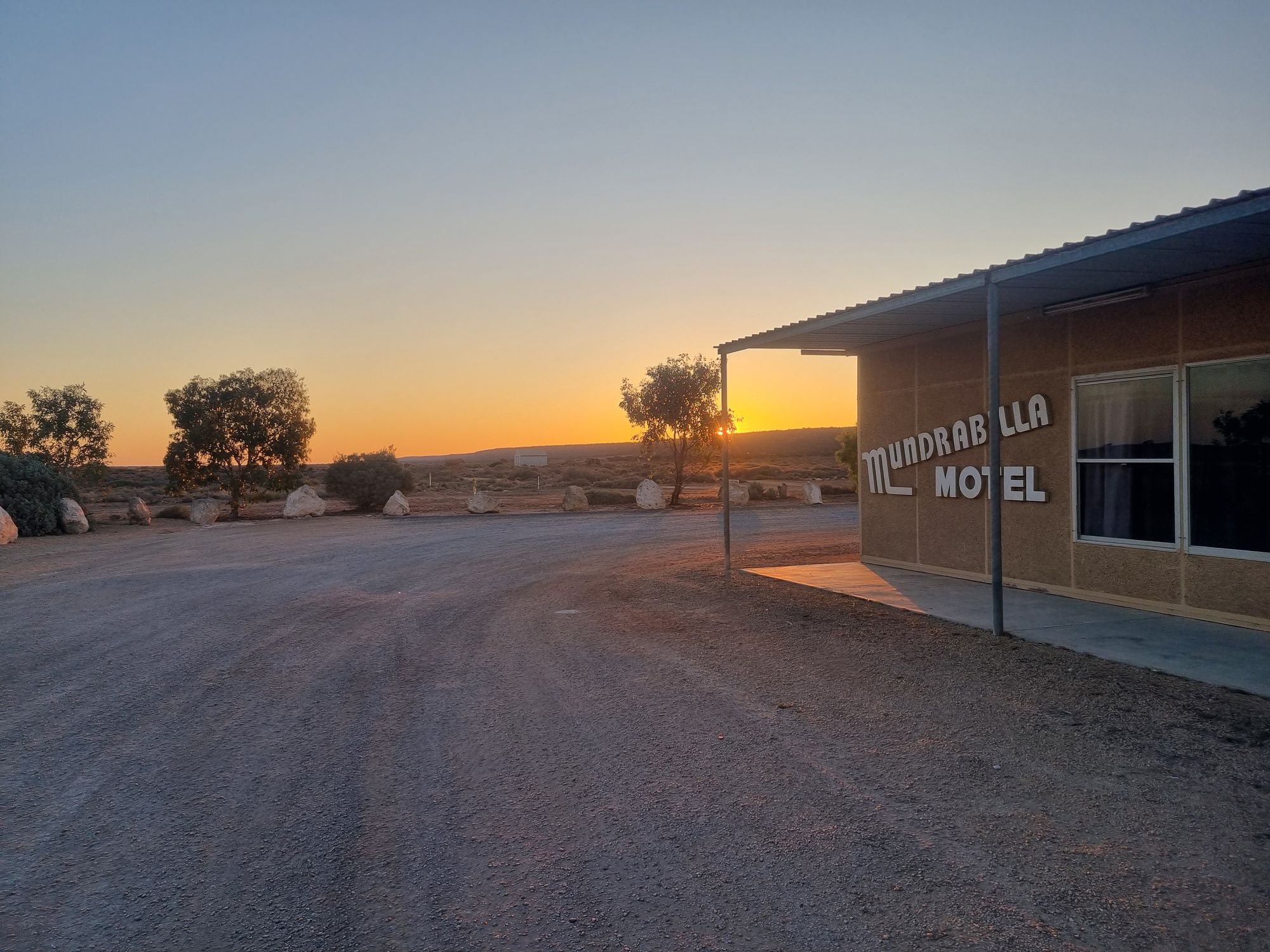
Made it just in time.